As you drive the
road to Camp
Whitsett, you are about to see what the mistake of one person did to
change
the lives of thousands of others. You are about to witness how one
person
can change the face of the world for your lifetime. You are about to
see
the awesome power of Nature gone wild. Yes you will see destruction,
but
when you arrive at Whitsett, you will see a miracle --- Whitsett stands
untouched for your camp experience. Once in camp, it will be hard to
realize
that a fire burned up to Whitsett's boundaries.
..
 |
If
you come through
Kernville you will see sights that might frighten you, but remember,
everything
is OK now and everyone will be safe. So sit and watch. After leaving
Kernville
you will travel up what is known as Mountain 99. Near Campground 3 you
will see charred ground. This is from a fire that broke out earlier
this
summer and closed the road for a few hours. It won't be until about the
five mile further that you will see evidence of the McNally Fire. |
..
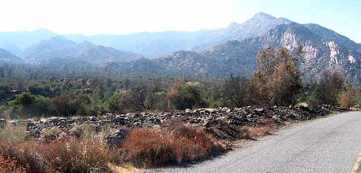
The McNally fire started
in
a place just before the Road's End Resort. It burned through Road's End
and on up river, and also burned down to here. Look around. There were
lots of bushes and some trees. The fire wasn't too hot here so things
don't
look too bad. Notice the white ash on both sides of the road and across
the river. There were exceptionally hot spots in the fire. You will
continue
up the road and see a lot of blackened earth.
..
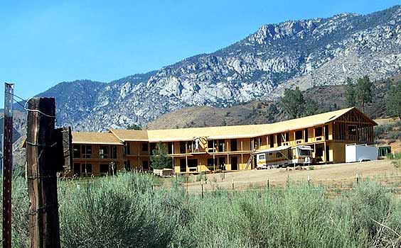
| There
is a building
site at Corral Creek, a nice place along the Kern River with a great
beach.
The fire didn't reach this area. Imagine how you would feel if you were
building a new resort area and it got burned before you even finished?
These people probably feel very lucky that they weren't burned out.
Perhaps
next year they can tell their guests the story about how close the fire
got to them. |
 |
..
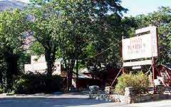 |
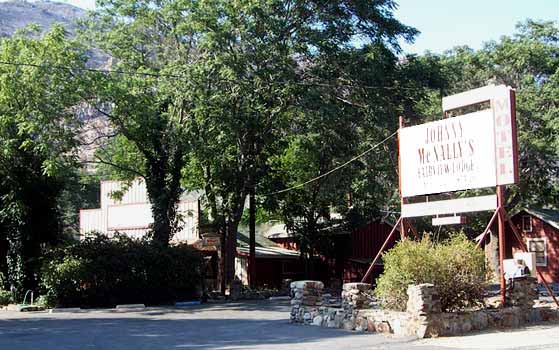
As
you continue to
drive up the road, you will soon come to Johnny McNally's "Fairview on
the Kern". McNally's is one of the oldest places along the Kern.
Started
many years ago by Johnny McNally, the Deputy Sheriff at that time, it
became
famous for serving great steaks. Today it still serves some of the best
food along the river. During the day, the Hamburger Stand keeps up the
tradition of great food. This resort was saved in the fire, which is
good.
But, be ready. One mile up is Road's End. |
..
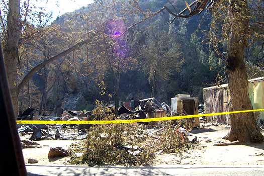
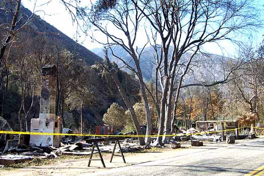
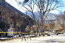
At
one time, Road’s
End was the end of the road up river from Kernville.This was once a
nice
resort with lots of green trees overhanging the road. It was usually
very
cool here because of the trees. When you pass through it, you can see
all
the destruction. The chimney off to the left is all that is left of the
old restaurant. This restaurant, at one time was known for excellent
prime
rib dinners---slow cooked prime with with excellent side dishes, and
super
desserts. The restaurant, bar and store stood on the left side of the
road:
they are all gone. There were some cabins and beautiful trees on the
right:
they are all gone. But, like in all disasters, three of the cabins on
the
left were untouched. Strange, isn't it?
.
.
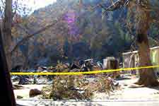 ..View
of the right side. ..View
of the right side. |
. |
..
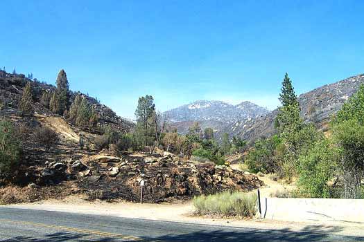
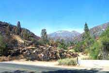
As you leave Road's End,
you
will see burned earth all the way up, with green places along the way.
These green places are what the whole trip looked like. You'll travel
several
miles following the winding Kern River. Look to the right up the
mountain,
this was one area that suffered lots of burning. See the white ash I
mentioned
earlier?
..
 |
The
road continues
around and past Limestone Campground. The really green area on the
right
covers a natural spring. Lots of people come up here just to collect
some
of the cold spring water. The rock area is usually wet from spring
runoff.
Around the corner you come across Brush Creek. See how far up the
mountain
the creek runs? Before the fire you could only see green right off of
the
road. You couldn't see 25 feet past the road. |
..
The road continues to
curve
around following the river. The water intake for the Kernville Power
Plant
is on the left. River water runs in here, gets strained and slowed
down,
and enters large water pipes to run to Kernville. When you go back
down,
you can see the huge pipes running beside and under the road. A few
miles
on up the road you come to the Johnsondale Bridge. The fire ran up on
the
left toward Johnsondale and Whitsett.
..
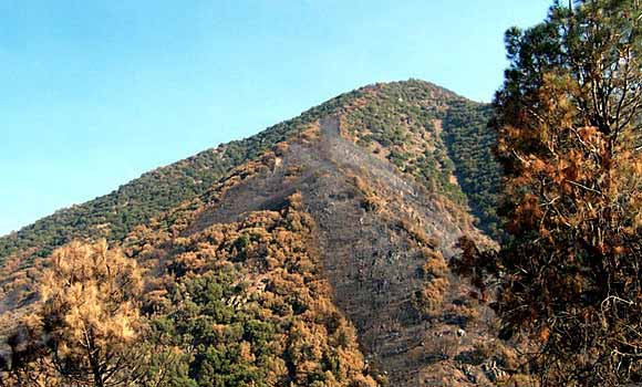
| As
you travel up
this part of the road, you will witness the worst destruction yet.
There
was a lot of brush growing on the sides of the road. In some places you
couldn't see very far. Now you can see the edges of the road (didn't
know
it was such a steep drop, huh?). Just past Lower Durwood you come to
the
hairpin turn. It used to be hard to see around the bend, it's easy now.
The mountain on the other side was burned terribly. Notice whole areas
missing anything. There were some trees and a whole lot of brush ---
all
gone now. |
. |
..
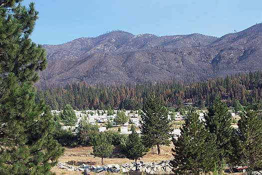
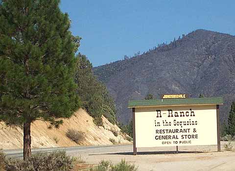
 |
The
road finally
winds into Johnsondale, The "R" Ranch. Look on the hills behind
Johnsondale.
The U.S. Forest Service built backfires here. Those fires burned toward
the main fire so that when the main fire got here there was nothing to
burn. That was how Johnsondale was saved. If the fire had been faster
or
the Forest Service couldn't have built the backfires quickly enough,
Johnsondale
would have been burned. And, if Johnsondale had been burned, Whitsett
probably
would have gone too. As it was, the fire burned to the right of the
road
and was stopped at Whitsett by more backfires and by the cutting of
wide
fire breaks.
.
.
The
"R" Ranch sign.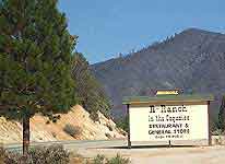
|
..
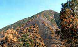
The road from here on
looks
fine. No fire got into the area. From here to Whitsett looks just fine.
This should relax you to enjoy Whitsett knowing that the fire spared
us.
As you drive in, look at Sentinel Peak. See the large pink/orange spot
on the lower right side? That is the fire retardant that was dropped to
keep the trees at Sentinel from burning. Close, huh?
..
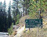 .The
Road sign just before the Whitsett turnoff --- Go right!! .The
Road sign just before the Whitsett turnoff --- Go right!!
..
As you drive along the
last
three miles, you can probably get a glimpse of the fire way off to your
right. Maybe next year, or when you return, we'll be able to take trips
to see what a major Forest Fire can do. For now, we are limited to
Whitsett.
See you in camp.
..
Some Questions for you:
..
How many miles of burned
area
did you see? __________
..
..
What was the most scary
sight
you saw?
..
..
..
..
..
What was the most
awesome sight
you saw?
..
..
..
..
..
Did you see any smoke
from any
hotspots? __________
..
..
How long do you think it
will
take for trees to grew back as big as they were before the fire?
..
..
What are some of your
feelings
about the fire damage and the spots that were untouched by fire?
..
..
..
..
..
..
..
..
..
NOTE: from
Gary Plumtree, ASM T176. If I have done my calculations right, this
fire
has now burned 1/10th of 1%
(1/1000) of our state and some of the nicest scenery.
|
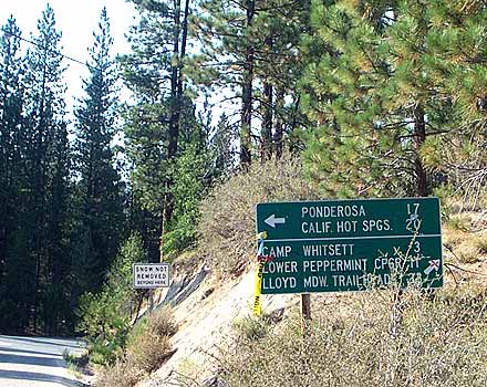 .The
Road sign just before the Whitsett turnoff --- Go right!!
.The
Road sign just before the Whitsett turnoff --- Go right!!